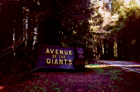
Franklin K. Lane Grove
Redwoods are the tallest and largest trees in the world.
There are three genera of redwood trees, each consisting of a single species. Two of these, the coast redwood and giant sequoia are native to California. The third, the dawn redwood, is found in China. (A dawn redwood has been planted near the front door of the office at park headquarters.)
Fossil records show redwoods lived in many areas of North America, Europe, Japan and even in Siberia. As a result of climatic changes and glaciation, the coast redwood now grows naturally only in a narrow belt about 40 miles wide and 450 miles long, extending from the southwestern edge of Oregon to southern Monterey County.
Some of the most spectacular portions of coast redwood forest remain in Humboldt and Del Norte counties.
Picnic and restroom facilities are available here. A leisurely twenty minute loop trail begins here as well.
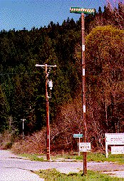
Stop #2
Lansdale Grove
A movement to protect ancient redwoods began in the 1800s. In 1864, the Mariposa Grove of redwoods was set aside in Yosemite. In 1902, the California Legislature set aside an area of redwoods now known as Big Basin State Park near Santa Cruz. This was our first state park.
Humboldt Redwoods was the first northcoast redwood park to be established through the efforts of the Save-the-Redwoods League in 1921.
When large trees fall in the forest, they can take hundreds of years to decay. Many species of insects, amphibians and mammals use them for shelter or food. As the trees continue to decompose they can store large amounts of water and release nutrients which other trees tap into for food.
Stop #3
Bolling Grove
The Bolling Grove was the first Memorial grove purchased for what is now Humboldt Redwoods State Park. It was dedicated in 1921.
The newly formed Save-The-Redwoods League made this purchase in order to "rescue from destruction representative areas of our primeval forests."
This Grove was the first of a rich legacy that has been a major factor of the preservation of "this titan race" that continues to grow to this day.
There are over 130 groves within Humboldt Redwoods State Park, many of which you will see as you drive along the Avenue. The grove dedication process is still continuing. Contributions may be made for groves or single trees. For more information contact the Visitor Center or park headquarters.
On the river side of the Avenue you can locate a tree with many burls and near it another tree that has a unique growth technique. Two trees have grown together for the lower 26 feet. At the 42 foot height the trees have again grown together.
Stop #4
Visitor Center
Stop here for information about Humboldt Redwoods State Park. The Visitor Center has many displays that interpret the redwood environment.A slide show captures the beauty of Humboldt Redwoods throughout the seasons. There are also videos for your viewing that explain redwoods, plants and animals of this region. Natural history books and mementos are available to purchase. The Humboldt Redwoods Interpretive Association is made up of volunteers who donate their time at the Visitor Center. The Auto Tour pamphlets are funded by the Association for the public's education and enjoyment.
For more information on association membership, call the Visitor Center at (707) 946-2409 or send us e-mail at: hrsp@northcoast.com.
This area was originally called Burlington for the number of burls found here in the forest. It was also a railroad tie camp in the early 1900s.
Stop #5
Weott
This sign indicates the high water mark from the 1964 flood. The townsite of Weott used to be here, but most buildings were washed away in the flood.
During the 1964 flood, water was more than 33 feet above the road at this location. Heavy winter rainfall is a prominent feature of the redwood region, as are summer fogs that keep moisture in the air for the trees to use. Though the average rainfall in this area is 65 inches, amounts of as much as 120 inches have been recorded.
The flood of 1964 occurred in a relatively average rainfall year. Other factors brought the disaster to a climax. Snow had fallen in the mountains just before several days of very heavy rainfall came. Since much of the Eel River watershed had been logged, rainwater and snowmelt quickly ran off into the river. The river channels that historically were deep, had silted in and could not hold the volume of water that came roaring down. The highest tide of the year held back the river water near the mouth of the Eel 35 miles away. Residents of Weott saw their town, once thriving, lose 54 buildings. Virtually all those buildings left standing in the low areas were damaged. The small towns of Myers Flat and Pepperwood were devastated and several lives were lost. A sign showing the high water mark of 1964 is located at the corner of the Avenue and Newton Road.
Stop #6
Dungan Grove
Redwoods are often called the "Tall Trees" because they are truly the giants of all living things. Several trees in Humboldt Redwoods are over 360 feet tall.The average old growth redwood is between 500 and 700 years old. This long life allows the trees to attain such a great height.
Why do the redwoods live so long? The redwood has remarkably few insects that feed on it and is seldom seriously injured by fungi. Fire has a hard time consuming mature redwoods since there is little pitch or resin in the wood and the thick bark is fire resistant.
Flooding, which can suffocate many trees, brings in beneficial silt to the redwood forest. Redwoods can send up new roots into the sediment deposits. This silt also reduces the competition of other tree species on the flooded flats.
A large burl (an uncontrolled growth of cells) is evident on the tree next to the road on the east side (roadside away from the river).
Trails radiate from the parking spurs on each side of the road for short 5-10 minute strolls in the forest.
Stop #7
Mahan Plaque Trail
The Mahan Plaque Loop trail starts at location #7 on the east side of the road and is a .6 mile loop. The Plaque commemorates Laura and James Mahan, who, in 1924, were instrumental in getting this grove and the Rockefeller Forest protected as they were about to be logged. Shortly afterwards, the grove was purchased by the Save-the-Redwoods League.Approximately 1/4 mile north from this stop, take the road that says South Fork for 1/8 mile to the Founders Grove Parking Lot and trailhead. This easy 20 minute self-guided nature trail tells about ancient redwood forests and is the most popular trail in the park. The Founders Grove was dedicated in 1931 to the founders of the Save-the-Redwoods League. The League has been instrumental in contributing over $43 million to protect 250,000 acres of redwood land in the 31 California State Parks and Redwood National Park.
Stop #8
Dyerville Overlook
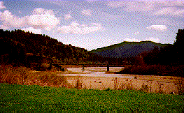
From Dyerville Overlook, you can see the railroad bridge over the forks of the Eel River. This bridge had two spans washed away in the 1964 flood.
As you look down to the river you can see the junction of the South Fork with the main stem of the Eel River. The Eel River was named for a fish with an eel-like appearance called a lamprey. Lamprey can often be seen in April and May when they migrate into the river from the ocean to spawn.
Fishing for salmon and steelhead can be an exciting experience in the fall and winter. More sportsmen are practicing catch and release fishing to help reduce the decline in the populations of these beautiful fish. High summertime river temperatures preclude a year around trout fishery in the Eel River.
A worthwhile side trip from here would be to turn West on the road into the Rockefeller Forest 1/4 mile south of this stop. The Mattole Road winds picturesquely for six miles through this magnificent forest. There are two parking areas (Bull Creek Flats and Big Trees Area) that give access to trails in the forest. Covering more than 10,000 acres, this is the largest remaining Ancient Redwood forest in the world. The forest gives one a glimpse of what much of the North Coast looked like hundreds of years ago.
Stop #9
Drury Chaney Groves
One of the most beautiful trails in Humboldt Redwoods starts here and lazily winds through the forest. The redwood sorrel (oxalis) carpets the floor and in the spring has dainty flowers poking through its clover-like leaves.As you walk the gentle path, try to imagine the awe and wonder felt by the first Native Americans who walked through these forests. Perhaps you can also feel the reverence with which they treated these trees. Look at the slowly decaying giants that have fallen. They are still giving life to young plants and animals that depend on this decaying wood for their very life. This is a forest where every square inch has a purpose.
Across the road is one of many areas that park personnel are actively replanting with thousands of trees to restore the lands to their original forested conditions.
Whichever way you travel the Avenue, we hope your trip will be enlightened and enjoyable. Please come to stay at Humboldt Redwoods State Park anytime of the year. Each season reveals a new wonder in these redwood forests.